
Table of Contents
The Floe Lake hike is one of the most popular in British Columbia’s Kootenay National Park – and for good reason. Floe Lake itself is a stunner – a turquoise-coloured alpine gem beneath the soaring cliffs of the Rockwall, ringed in part by larch trees. Not only is it a fabulous day hike, but it’s either the first night or last night on the Rockwall Trail – a popular, multi-day bucket list kind of backpacking trip. And for those that can score a campsite, it’s a great one-night camping trip.
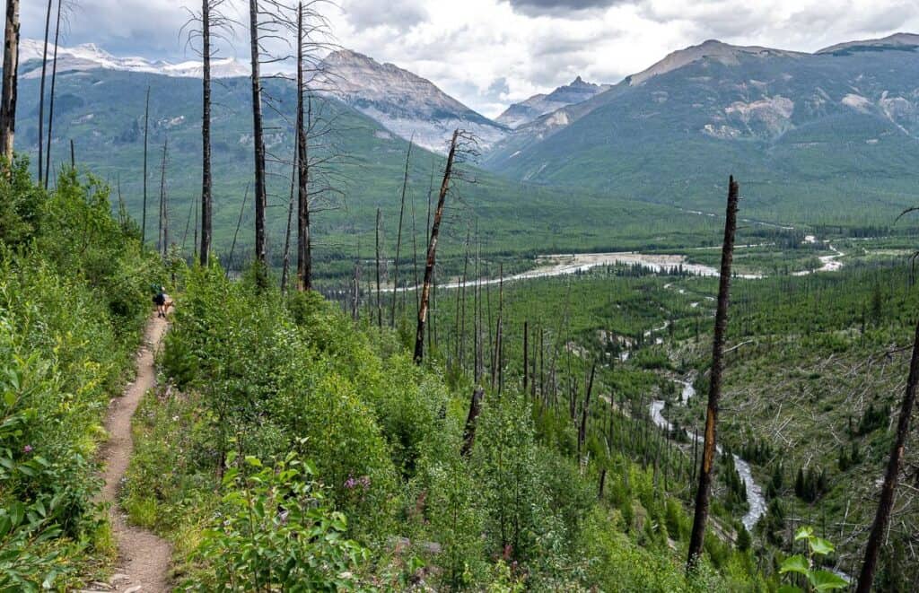
Thanks to the 2003 wildfire, the hike to Floe Lake offers stunning views for most of its length. The remains of grand old trees are still there but so are large swaths of pink fireweed and at least five types of edible berries. I found the log-filled creek at the bottom of steep drainages to be quite a sight – probably the result of avalanche activity over the years.
For many people, a day hike to Floe Lake will be a sufferfest. With 800 metres of elevation gain (and loss) and 21 kilometres of hiking, count on a long day. But with the competition for getting a campsite up at Floe Lake at a premium, I think it’s worth it. Plan to get an early start so you can enjoy an hour or two at the lake.
This post includes some affiliate links. If you make a qualifying purchase through one of these links, I will receive a small percentage of the sale at no extra cost to you. Thank you very much for your support.
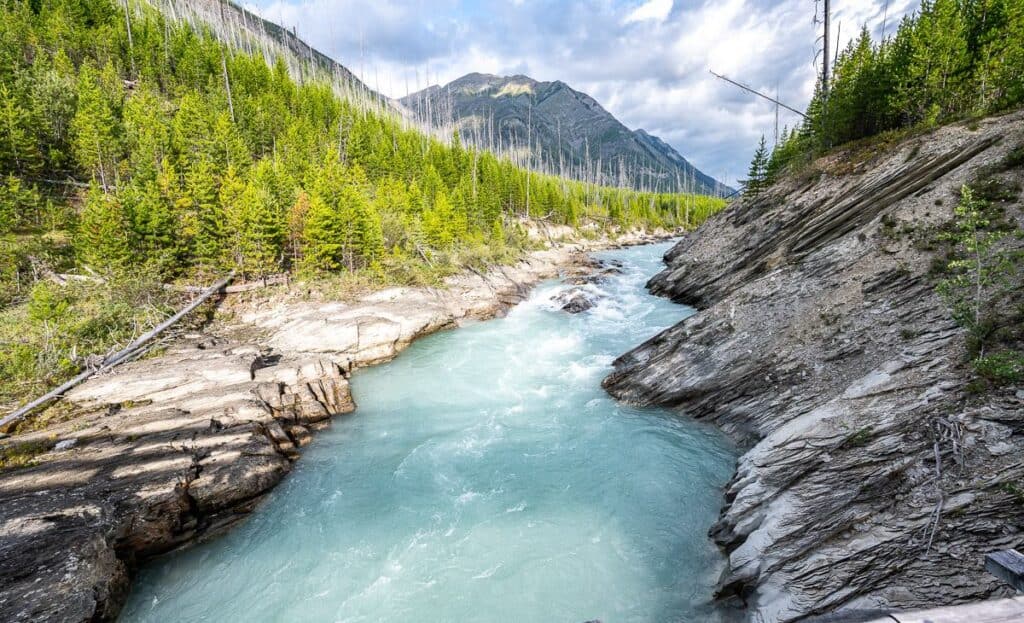 Looking up the Vermilion River at the start of the Floe Lake hike
Where is Floe Lake?
Floe Lake is in Kootenay National Park, close to the boundary with Banff National Park. The trailhead is a 45-minute drive from Banff, 38 minutes from the Lake Louise townsite, and 50 minutes from Radium Hot Springs.
We did the Floe Lake hike as a day trip from Calgary, with a two-hour drive in each direction. Don’t forget to pack after-hike snacks and cold drinks for the drive home.
There are no services in Kootenay National Park. Pack all the food you’ll need for the hike ahead of time, gas up the car, and let people know where you’re going as there is no cell service.
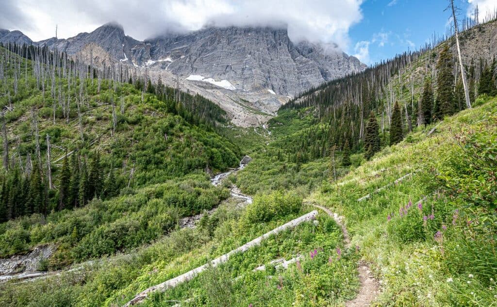
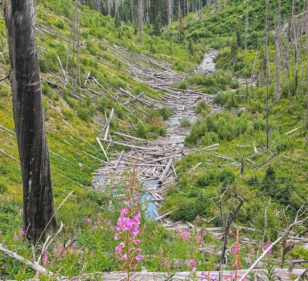 Log jam in Floe Creek – leftovers from the fire brought down by avalanches
Floe Lake trailhead and parking
The Floe Lake trailhead on Highway 93 in Kootenay National Park is easy to find. A parking spot on a sunny weekend might not be. I recommend getting to the trailhead early. One weekend we saw dozens of cars parked along Highway 93. I’m not sure what Parks Canada thinks about that.
Getting to the trailhead from Radium
From the intersection of Highway 93 with Highway 95 near the west gate of Kootenay National Park near Radium drive 71.5 km north. The Floe Lake parking lot is on the southwest side of the highway.
Getting to the trailhead from the Trans-Canada Highway
From Castle Junction on the Trans-Canada Highway, drive 32.3 km south on Highway 93. The trailhead will be on your right. (Note that there is a gas station in Castle Junction.)
The Floe Lake trailhead elevation is 1,348 metres or 4,420 feet.
The GPS coordinates for the trailhead are 51.08751253541266, -116.05493546922641. See the Floe Lake location map below for more details.
Floe Lake location map
Floe Lake hike & camping summary
Distance: 21 km return
Type of trail: Out and back though there is the challenging option if you can arrange a vehicle shuttle to hike to Floe Lake and return to the Numa Falls trailhead. It’s a 27.5 km loop with about 1,000 m of elevation gain.
Elevation gain: Approximately 800 metres or 2,625 feet to Floe Lake.
Time needed: 6 – 8 hours depending on hiking speed. Add an hour for lunch at the lake.
Level of difficulty: Hard because of the distance.
Dogs: Permitted on a leash.
Map: Gem Trek Kootenay National Park as a waterproof paper map. I’d also recommend a hiking app like Organic Maps – that you can use for free offline.
Permits needed: You will need a Parks Canada pass to hike to Floe Lake. You can purchase a day pass, though if you’re planning to visit a number of national parks over the course of a year, I’d recommend the Discovery Pass.
Weather forecast: I created a free account on Windy as I find their forecasts to be accurate.
Best season to hike to Floe Lake: Plan to hike to Floe Lake after the snow has melted, usually by July 10th when campsites open. A sunny but not to hot summer day is lovely, but so is larch season later in September.
Campsite reservations: Opened on January 27, 2025, at 8 AM MT but the date varies from year to year.
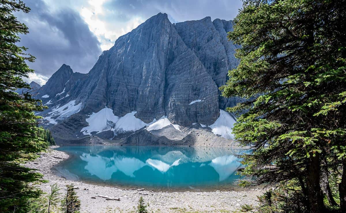
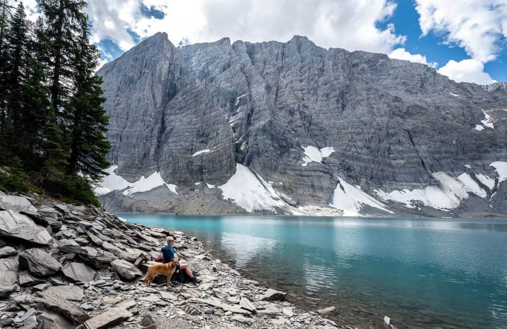 Our scenic lunch spot at Floe Lake in Kootenay National Park
Floe Lake trail description
The Floe Lake hike is an easy one to follow. There is a large trailhead sign at the start of the trail letting you know what’s in store.
Start with an easy walk through the woods and then descend to a bridge over the Vermilion River. Admire the views up and down the river before continuing on a mostly level trail. Cross a sturdy bridge to the north bank of Floe Creek at 1.7 km.
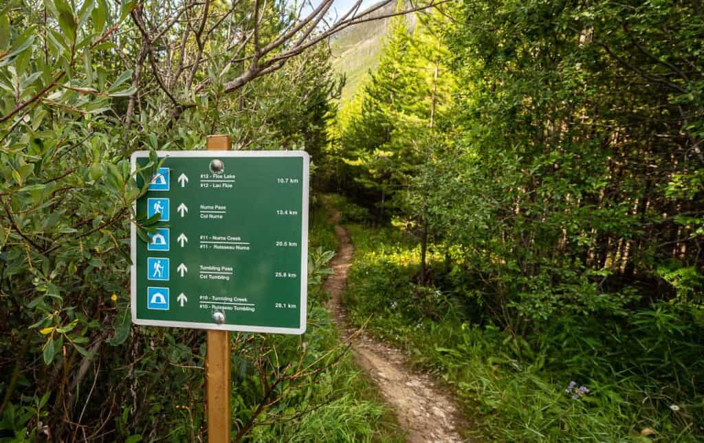 Mileage sign at the start of the Floe Lake hike
 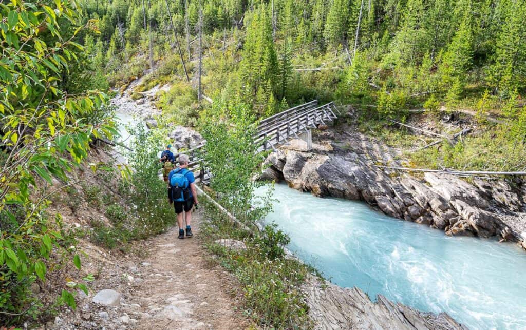 Cross the Vermillion River to start the Floe Lake hike
After you cross the bridge the trail turns southwest. You can see the trail from Highway 93 once you know where to look. It follows the narrow Floe Valley until you start switchbacking up to Floe Lake.
The treeless landscape (with relentless sun on hot days) affords fantastic views across to the Ball Range. As you climb higher enjoy the sight of the impressive Rockwall off in the distance.
Look for wildflowers through the burn including pink fireweed, yellow arnica, purple asters, and purple-blue harebell. Berries abound on the hike to Floe Lake too. We had to stop and sample a couple of raspberries and black currants though we gave the elderberries and Saskatoon berries a pass. The bears must be very well fed this year as I didn’t see any bear scat or diggings.
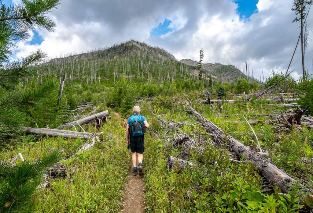 Hike through the remains of the August 2003 Verendrye Creek fire
 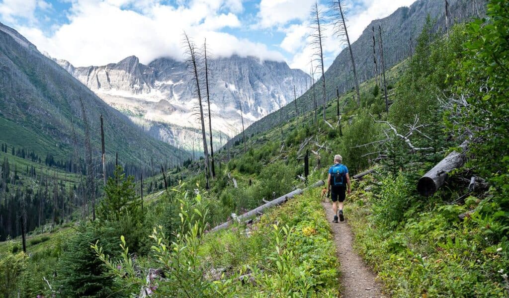 Loads of berries and wildflowers through the old burn
 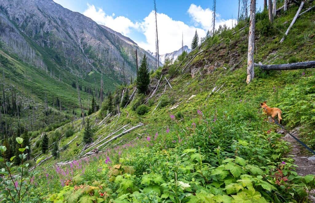 I love the vista you see on the hike to Floe Lake
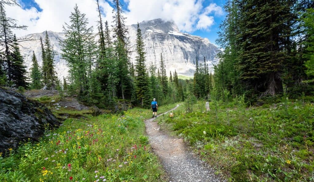
When the trail starts to steepen, you’re about 2 km from Floe Lake. However, you gain half the elevation of the whole hike in those two kilometres. You’re back into the trees for most of the climb, a relief if it’s a hot day.
 The Floe Lake hike is about to steepen considerably
 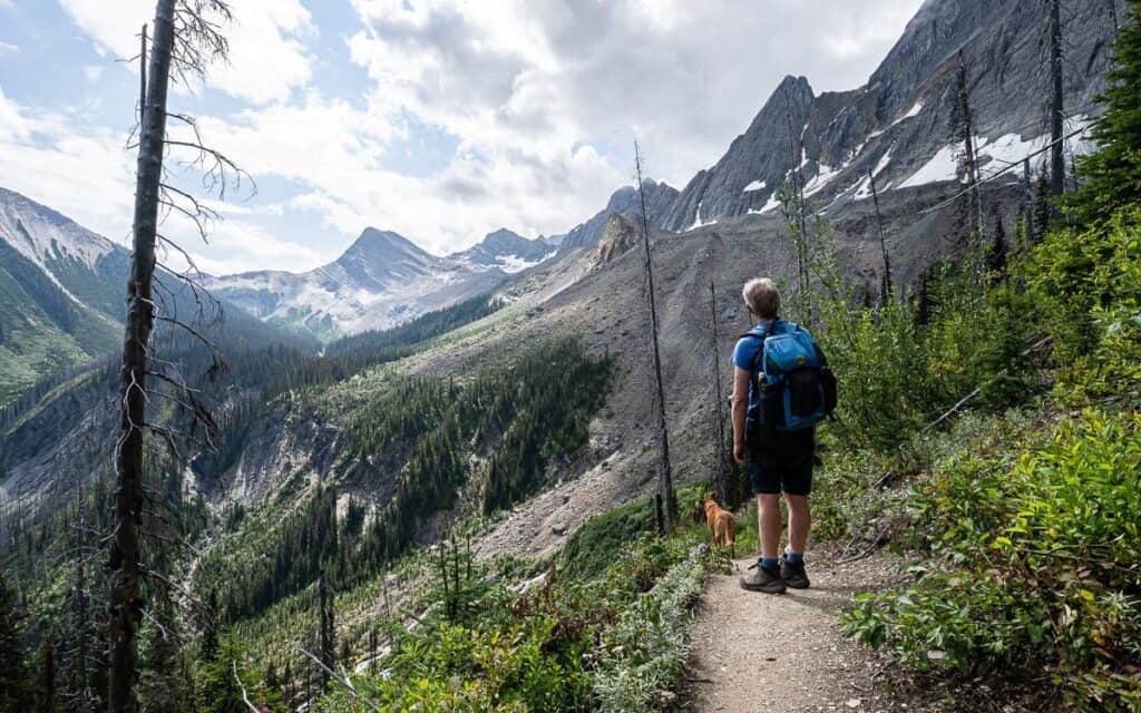 The hike to Floe Lake starts to steepen around here
 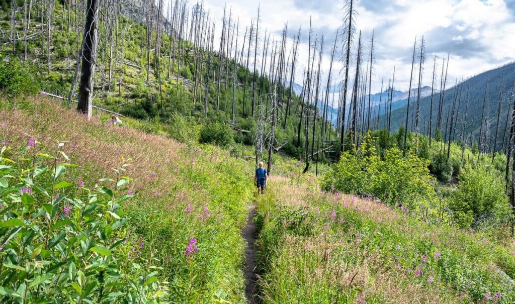 Looking back at John and the burnt trees from the 2003 forest fire
Arrival at Floe Lake and Rockwall views
When the Floe Lake trail starts to level out, you’re almost at Floe Lake. Revel in the beauty of the prolific wildflowers as you make your way towards the lake and the first of the 18 campsites.
Enjoy lunch down by Floe Lake so you can soak in the view of the Rockwall. Some of you might want to go for a cold plunge. Many of you will simply want to sit and relax. No matter how you enjoy the turn around point, you’ll find Floe Lak to be one very special place in Kootenay National Park – and one of the top sights on the 55 km long Rockwall Trail.
 When the trail flattens out and wildflowers appear in large quantities it means the hike to Floe Lake is almost over
 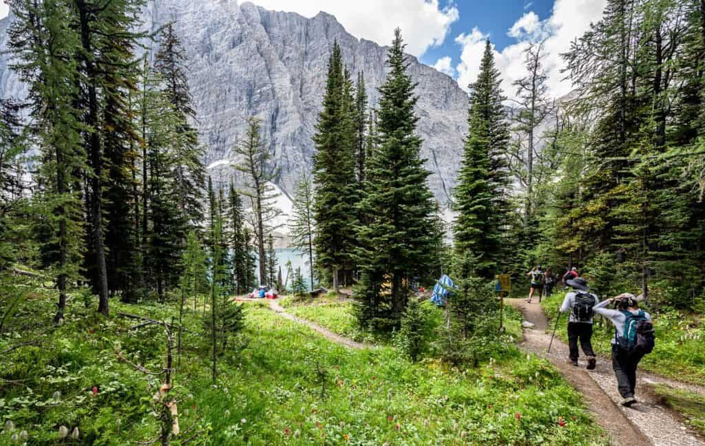 Almost at Floe Lake in Kootenay National Park
 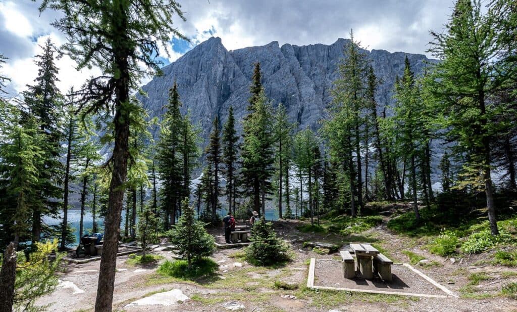 The eating area for campers overlooking Floe Lake
 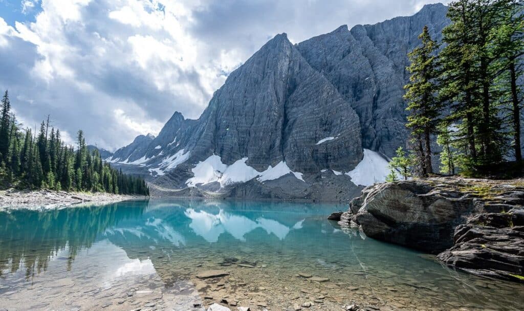 View of Floe Lake near the eating area
 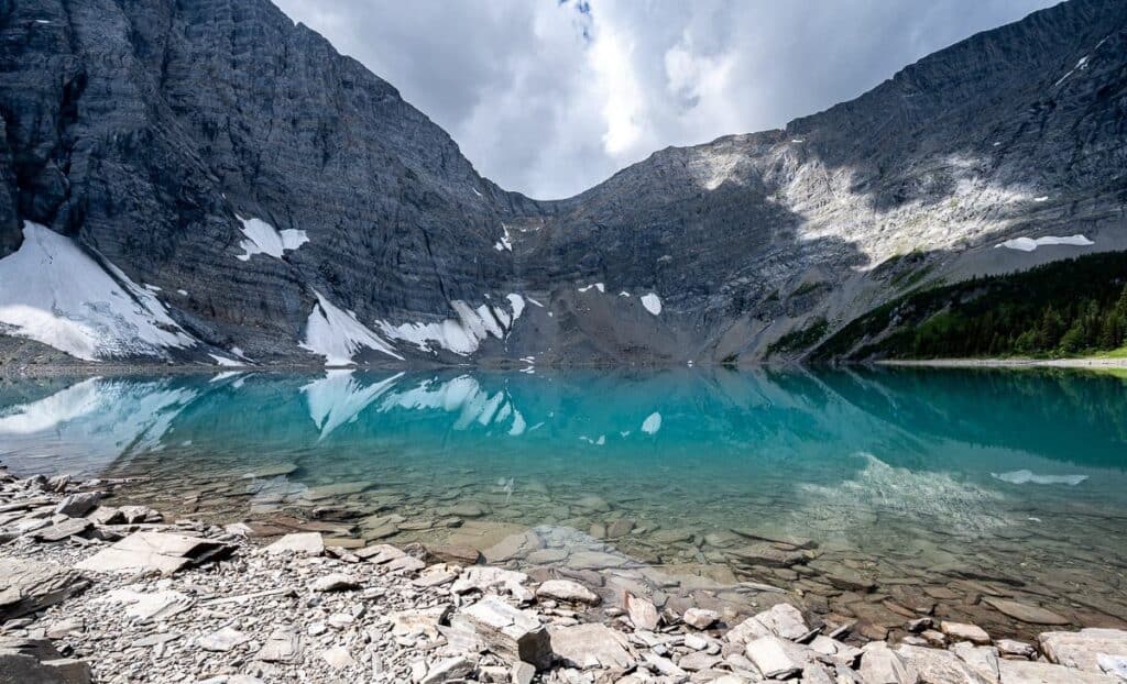 Floe Lake is a special place to hang out at
Camping at Floe Lake
Floe Lake is a great overnight destination – but it’s a difficult to snag a campsite. That’s in part because Floe Lake is also the southern terminus of the Rockwall – a world-class backpacking destination, and of the top backpacking trips in the Canadian Rockies.
Campsite reservations open sometime in January or February with the dates varying from year to year. Be prepared to jump online five to 10 minutes before reservations open at 8 AM MT. All 18 campsites are usually gone within an hour. (Be sure to set up a Parks Canada account beforehand too.) There is an online reservation fee of $11.50, ($13.50 if you reserve over the phone) and a backcountry fee of $13.50 per person per night.
Note that Parks Canada does not book campsites at Floe Lake until July 10the because of snow.
The good news. Plans change, weather goes south, so there is always the possibility of getting a cancellation – though who really want to hike to Floe Lake in a downpour? I recommend signing up for Schnerp. Set up an alert and be notified when a cancellation occurs. Be prepared to act quickly when you get a notification.
Amenities at Floe Lake include bear-proof storage lockers, pit toilets and picnic tables with a view.
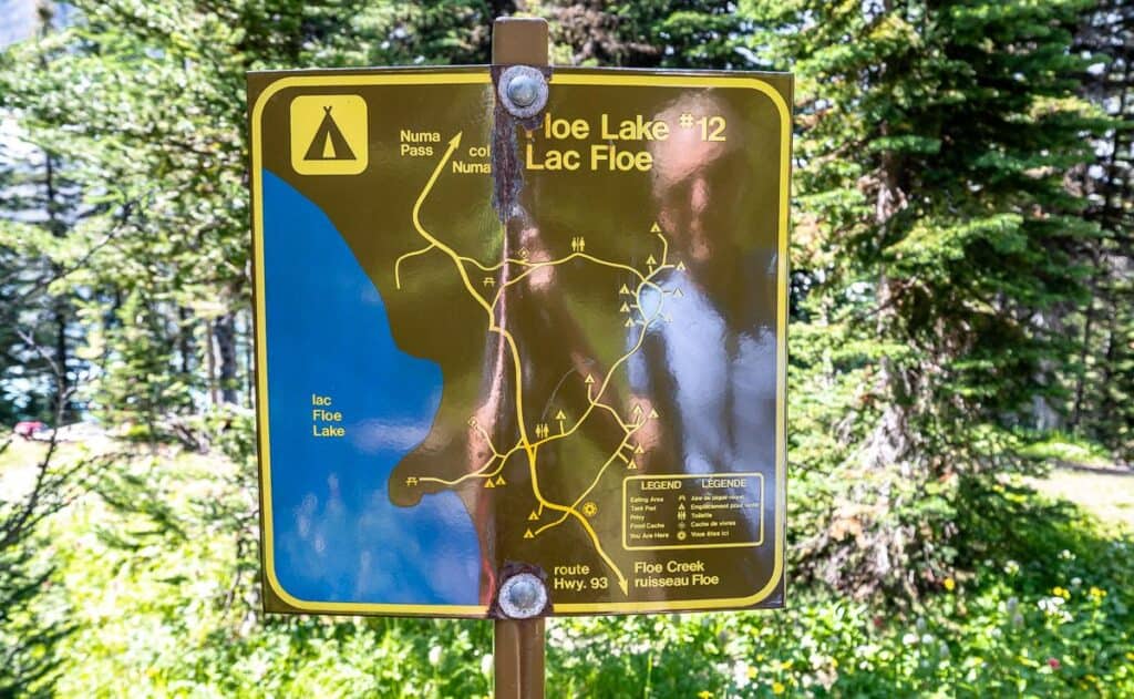 A location map of the campsites at Floe Lake (most are in the woods)
 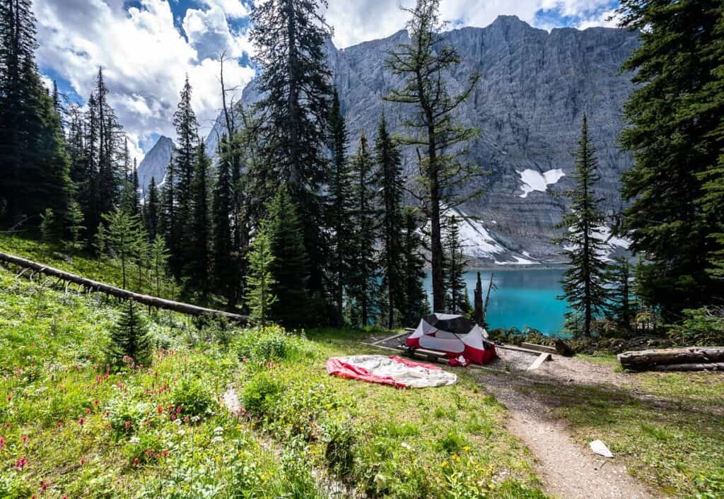 Campsite #12 overlooking Floe Lake has the best view of all
 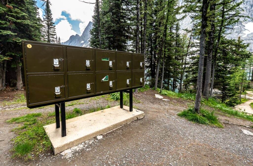 Bear lockers at the Floe Lake campground
If you have time and some juice in your legs
If you’ve got any juice left in your legs – and I did not – do the 2.7 km one way hike from Floe Lake up to Numa Pass – the highest point on the Rockwall Trail. You’ll have to climb another 315 m from Floe Lake to reach it and then return the way you came. The reward – a fantastic view of Floe Lake below you, Foster Peak to the southwest, Numa Mountain to the northeast, and Tumbling Pass to the northwest.
Safety and hiking tips on the hike
Cell service: There isn’t any along Highway 93 In Kootenay National Park. Storm Mountain Lodge would be the nearest place to make a call. Plan to carry a Garmin inReach Mini or other location device.
Wildlife: Judging by the number of berries (elderberry, raspberry, currants, Saskatoon berry) along the Floe Lake trail, you need to be vigilant in making noise and looking out for bears. Be sure to carry quick to access bear spray (I carry mine in a bear spray holster so I don’t set it off by mistake) and know how to use it.
Going prepared: Always pack the 10 hiking essentials and PLEASE practice the seven Leave No Trace principles. With high visitation, trails and campsites need to be left in better shape than we find them.
Hiking poles: Many of you will appreciate hiking poles especially on the steep section of the Floe Lake hike. I always opt for collapsible, lightweight poles.
Dress in layers: You’re in the mountains where weather can change in a heartbeat. Pack a raincoat, rain pants, and a lightweight warm jacket. I love this down sweater from Patagonia.
Pack high energy food: You burn a lot of calories on the hike up to Floe Lake. Pack a few protein bars so you don’t hit a wall. I also love Clif Bloks Energy Chews for an immediate energy burst.
Water: I don’t like to carry more water than I think I’ll need. When I know there is a lake in my future I pack water purification tablets and the Katadyn BeFree Microfilter.
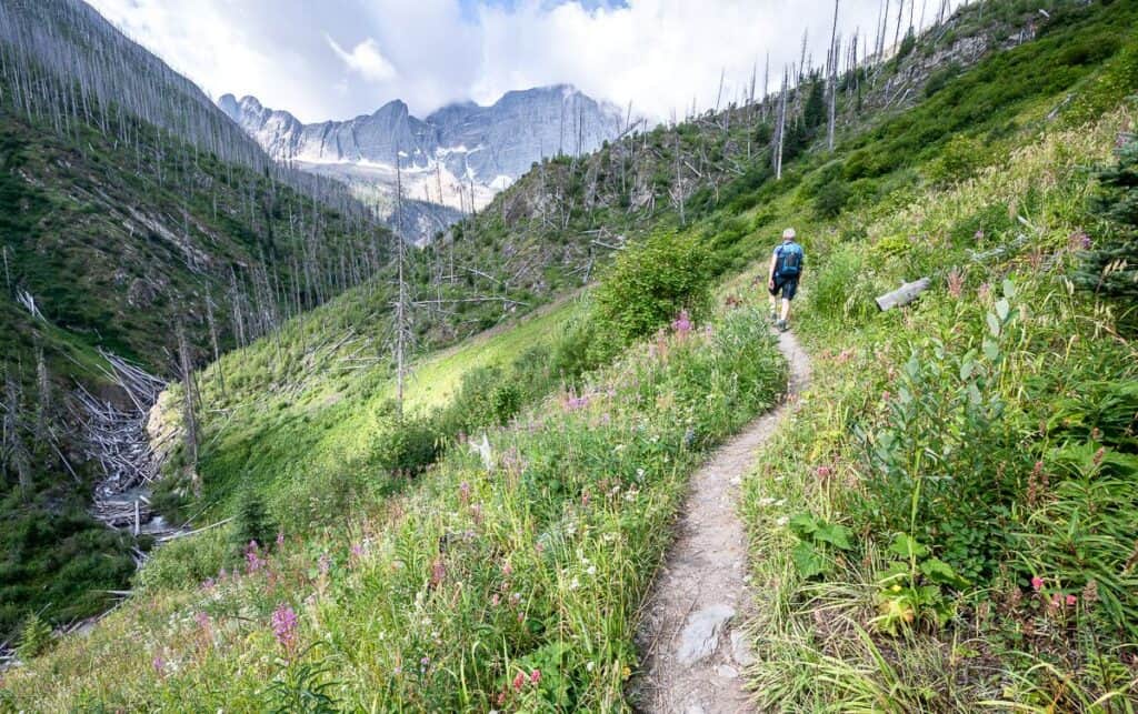 It’s a steady climb through a burned area on the way to Floe Lake but the wildflowers are outstanding
Places to stay near the trailhead
There are three frontcountry campgrounds along Highway 93 in Kootenay National Park. All three can be reserved online. Marble Canyon would be my choice if I wanted an early start on the Floe Lake hike. With its location, you could easily do the gorgeous and easy Marble Canyon hike after dinner.
- Marble Canyon has 61 unserviced sites and is open late June until early September.
- McLeod Meadows offers 88 unserviced campsites and is open late June until early September.
- Redstreak Campground in Radium is the only full-service campground in Kootenay National Park. It is open from mid-May until early October. The 242 sites consist of 10 oTENTiks, 19 walk-in tent sites, 50 sites with power, water and sewer, 38 sites with electricity and 125 unserviced sites.
If you prefer a roof over your head check out the following options.
Radium Hot Springs
The Prestige Radium Hot Springs Resort is rated as very good.
Bighorn Meadows Resort on the golf course is a great choice if you want a pool and prefer to cook for yourself.
Other options in Banff National Park
Storm Mountain Lodge & Cabins – back in Banff National Park, is only a 9-minute drive away. They offer cabins with wood burning fireplaces and a dining room and lounge.
Castle Mountain Chalets at nearby Castle Junction would also be a good choice. They have dog-friendly rooms.
In summer, check out Johnston Canyon Lodge & Bungalows located beside popular Johnston Canyon.
For those on a budget but not interested in camping, then the Castle Mountain Hostel would be a good option.
 Looking over to Highway 93 in the direction of the trailhead on the hike down from Floe Lake
More hikes near Floe Lake
Click on the photo to bookmark to your Pinterest boards.